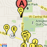
 When I had to make a custom map with locations of many local restaurants marked for a square dance weekend we’re hosting, I got my feet wet with the excellent My Places on Google maps. It’s easy to use, quite flexible and editable, and hosted for free by Google! Couldn’t ask for much more. This will definitely replace the DeLorme mapping tools I used to use.
If you’re logged into your Google account and go to maps.google.com and click the My Places button, you’ll see a Create Map button. It’s pretty straightforward from there.  The simple toolbar lets you pan and zoom to wherever you want, drop a map pin, or draw lines, routes, or shapes.
![]() While there’s a nice selection of default map pin icons available, I needed a bunch of similar ones with unique labels that would print in black & white. Googling numeric google map icons found these. Google doesn’t host custom icons, instead requiring a URL to an image, so I copied them to my web host. But when I tried to “Add an icon” it didn’t seem to work: the pin on the map disappeared, and “My icons” showed a broken image icon. It looks like there’s a short delay to propagate the new icons and you have to refresh your map to see them. After I made peace with that, making the map was a piece of cake.
While there’s a nice selection of default map pin icons available, I needed a bunch of similar ones with unique labels that would print in black & white. Googling numeric google map icons found these. Google doesn’t host custom icons, instead requiring a URL to an image, so I copied them to my web host. But when I tried to “Add an icon” it didn’t seem to work: the pin on the map disappeared, and “My icons” showed a broken image icon. It looks like there’s a short delay to propagate the new icons and you have to refresh your map to see them. After I made peace with that, making the map was a piece of cake.
The real URL of the map is long and ugly, so I sent a tinyurl of it to Lauren at work so she could capture an image to paste into a paper doc. When she gently pointed out on the phone that I’d misspelled the name of a restaurant, a couple of clicks and edits and saying “refresh your browser” got me an “Oh, it’s OK now.” Kewl. We’ll put the (tiny) URL on the paper as well as a QR code, so if we need to make any other changes at least browser-equipped dancers will see the latest version. That’s as close to updatable paper as we’ll get until we have those Harry Potter-style newspapers.
The bean counters have taken over at Google, so the google labs guys have lost a lot of their freedom to create new stuff. While I don’t claim to know or understand it, I suspect the financial incentive for Google to let this service exist is that while you can add your own layer of map pins and drawings, the base map on which they’re superimposed still has all the presumably paid-for business locations shown. To this user at least, that seems like a fair tradeoff.

I’ve used Google maps to document some of my longer bike rides.
https://maps.google.com/maps/user?uid=206000890439430532466&hl=en&gl=us
With their KML upload capability, I can load data from my old Garmin Etrex (almost) directly onto a map using gpsbabel.
As you have found, there are bugs. Last year for a long while you couldn’t delete any points but eventually they fixed that.